
This schematic sketch offers one reading of a crude sixteenth-century drawing of Kirkcudbright. Drawn 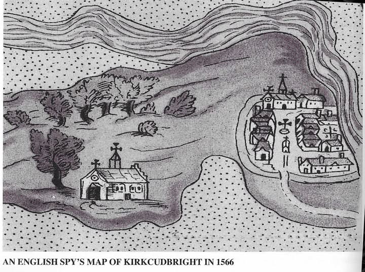 quickly for military intelligence during the reign of Mary, Queen of Scots, it isn’t to scale, and its precise interpretation remains open to debate. The original manuscript survived within the Cottonian collection originally housed at the British Museum, and it’s preserved today in the British Library in London.
The map illustrates Kirkcudbright viewed from the east, with the River Dee shown as the broad, banded channel along the top. The surrounding tidal mudflats and salt marshes of the estuary appear as the dense areas of dotted ground.
The early town sat on a low peninsula, almost isolated by a marshy creek that swept around from the harbour up to the Meikle Yett, the main gate. A defensive ditch and bank sealed off the neck of the peninsula, leaving a single causeway and gate at the bottom entry point.
Right in the centre of High Street, the spy drew a distinct building standing directly in the middle of the roadway, topped with a small spire or bell-house and a cross. This was standard positioning for an early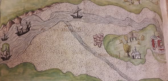 Scottish Tolbooth. Tolbooths were deliberately built as island structures mid-street to control market trade, collect burgh tolls, and assert civic authority, much like those at Dumfries, Edinburgh, and Sanquhar. The smaller structure drawn immediately in front of it represents the Mercat Cross, which stood in the middle of High Street in front of the Tolbooth before being re-sited to the forestair in 1760.
If this reading is correct, the drawing captures Kirkcudbright’s earliest known Tolbooth. This was the “auld tolbuith” whose building materials were sold off in 1577 after the burgh acquired the former Kirk of St Andrew as a replacement. That converted kirk eventually fell into ruin itself, described in 1625 as “ane ald decayit kirk… now altogidder decayit and fallin doun”, which ultimately forced the construction of the present Tolbooth between 1627 and 1629.
To the left, shown in isolation on a promontory framed by marshland, sits St Mary’s Isle Priory. St Mary’s Isle isn’t a true island, but rather a low promontory projecting into the Dee estuary south-west of the town, encircled on 3 sides at high tide by mud and water. Founded in 1161, the Augustinian priory served as a key landmark for anyone approaching Kirkcudbright by sea, making it a site of clear strategic value to an English military spy.