The Cochran Family and Kirkcudbright

Cochran Hall, Kirkcudbright Academy.

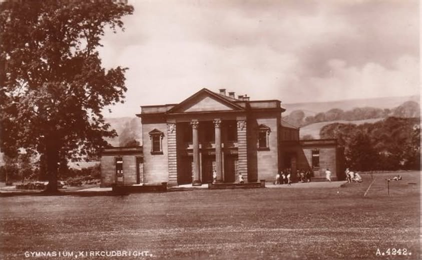
If you’ve ever spent time at Kirkcudbright Academy, or attended a local event in the town, you’ll almost certainly be familiar with the Cochran Hall. It’s a key part of the school’s footprint, serving as everything from an examination room and sports venue to a hall for community gatherings, but the story behind its name belongs to a world far from the Stewartry. The hall owes its existence to Thomas Cochran, an American investment banker whose generosity reconnected him with his family’s Scottish roots.
Born in St. Paul, Minnesota, in 1871, Thomas Cochran rose through the ranks of American finance to become a partner at the prestigious New York firm J.P. Morgan and Company. Despite his life being firmly rooted across the Atlantic, his family tree stretched directly back to the Stewartry, where his ancestors had lived generations earlier. He wasn’t someone who regularly walked the streets of the town, yet his lineage meant that when Kirkcudbright needed support, his name was high on the list of people to contact.

Kirkcudbright Academy underwent a major period of modernisation and expansion in the 1920s to cope with its growing role as the main secondary school for the surrounding district. The Kirkcudbright artist Edward Atkinson Hornel, who was himself a former pupil, sat on the local education committee and took an active role in raising funds for the project.

Hornel wasn’t hesitant about looking further afield, and among those he contacted was Thomas Cochran in New York, whose family had left the Stewartry generations earlier.

When Hornel’s appeal reached Cochran, the banker responded with remarkable philanthropy. He offered to finance a brand-new facility for the school as a lasting memorial to his Kirkcudbright forefathers. Designed
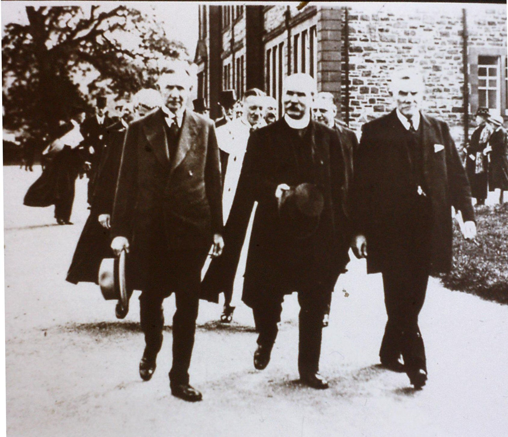
The opening of the Cochran Gymnasium. Provost Milburn in background

by the architect W.A. McKinnel, the building opened in 1931 as the Cochran Memorial Gymnasium. It was considered a fine addition to the academy, providing physical education facilities that were well ahead of their time for a rural school in the region.

Over the decades, the building expanded its role to become the versatile assembly space known today as the Cochran Hall. It’s played host to generations of school events, theatrical performances, and long-standing community traditions such as the annual Candlemas Ball. Though Cochran passed away in 1936 having spent his life in the United States, his gift ensured that his family name would remain stitched into the social and educational life of Kirkcudbright
Continue reading…

The ‘Big Snow’ of 1894-95

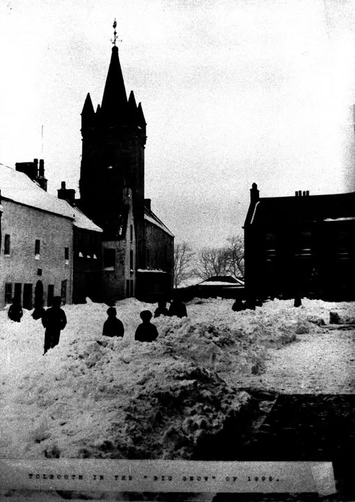
Local newspaper notices for the Stewartry itself are scarce for the hard winter of 1894–95. What survives is mainly the wider Scottish record of that long frost, together with this old postcard of Kirkcudbright’s Tollbooth standing in deep snow. The postcard gives a fair idea of how the town must have looked at the worst of it.

The frost began late in December 1894 and ran on, with only short breaks, into the second half of February. Here on the west coast the cold was less extreme than further inland, yet the snow that did fall would have settled and drifted under the north-easterly winds. Kirkcudbright, sitting on the estuary, is usually spared the worst of the inland storms, but that winter the snow came in on a sharp wind and stayed. The lower levels of the Tollbooth tower would have been half lost in the drifts, and the familiar High Street view narrowed by snow on the pavements and roads. The postcard of figures picking their way past the building is probably as close as we can get to the look of those days.

Further inland the difficulties would have been greater. Drifts along the quieter roads, such as the one between Dalbeattie and Auchencairn, could easily have risen above head height in places. The higher ground towards the Glenkens may have been cut off for days at a time. Farm tracks would have blocked, and the smaller settlements would have relied on neighbours to keep paths open. On the railway the Kirkcudbright branch and the line through Castle Douglas ran late or not at all when the cuttings filled. Coal deliveries and the movement of milk would have slowed until the lines could be cleared again.

Continue reading…

An English Spy’s View of Kirkcudbright: 1566

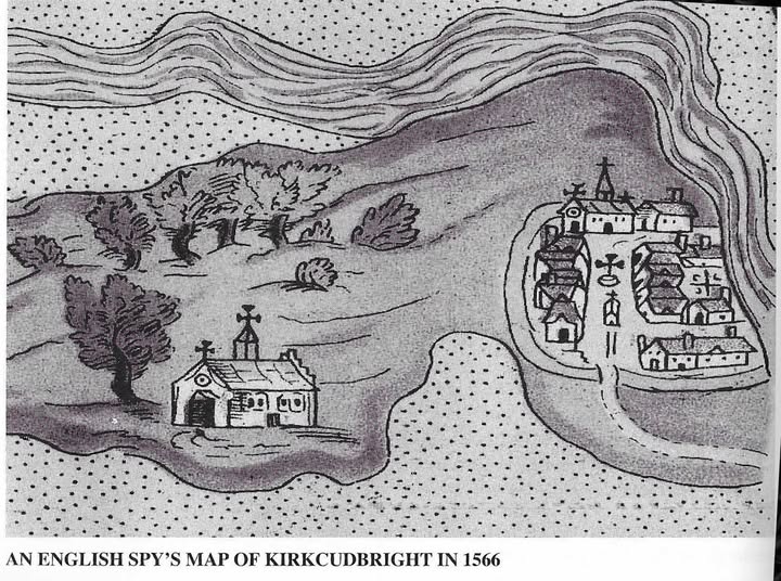
This schematic sketch offers one reading of a crude sixteenth-century drawing of Kirkcudbright. Drawn quickly for military intelligence during the reign of Mary, Queen of Scots, it isn’t to scale, and its precise interpretation remains open to debate. The original manuscript survived within the Cottonian collection originally housed at the British Museum, and it’s preserved today in the British Library in London.

The map illustrates Kirkcudbright viewed from the east, with the River Dee shown as the broad, banded channel along the top. The surrounding tidal mudflats and salt marshes of the estuary appear as the dense areas of dotted ground.

Continue reading…

Kirkcudbright High St.

In Scotland, the name of a street could hint at the status of the place around it. Many burghs developed a High Street at their centre: the broad route where markets gathered, proclamations were read, and civic life unfolded. Smaller villages often had a Main Street instead, a more practical name for the settlement’s principal road. The distinction was never absolute, but in places like Kirkcudbright the High Street still reflects the town’s long history as a royal burgh.

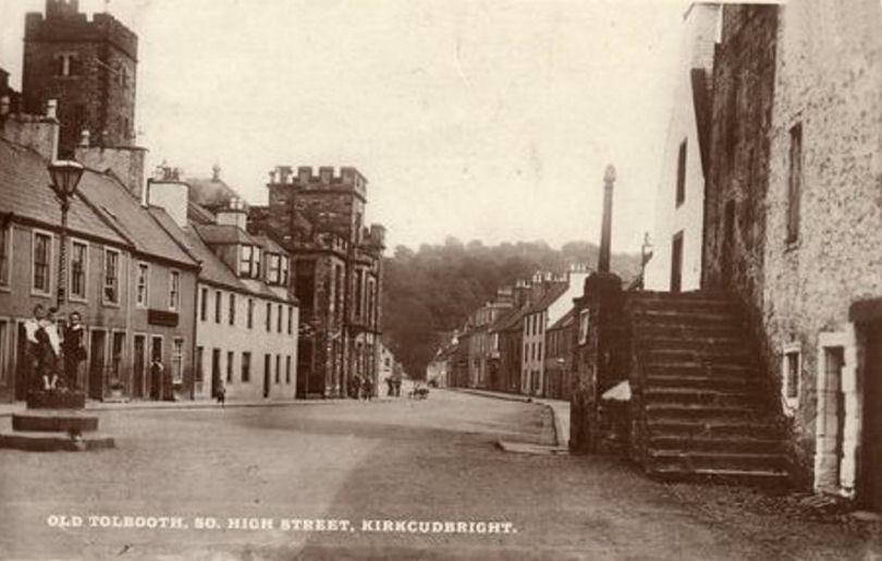
Chartered in 1455, Kirkcudbright held rights that smaller settlements did not: it could hold markets and fairs, levy tolls, and administer burgh law through its own council and courts. Much of that activity centred on the High Street, where merchants traded, notices were proclaimed, and townspeople gathered beneath the shadow of the Tolbooth and Market Cross.

On the ground, that meant markets existed by right, not by permission. When Kirkcudbright’s weekly market met, and when the big Michaelmas Fair rolled round each September, the L-shaped High Street, that always caught the wind off the Dee, filled with the business of the whole Stewartry. Farmers drove in cattle and sheep. Fish came up from the harbour. Weavers, shoemakers, and fleshers set out stalls. Deals were struck, debts were settled, and labourers were hired for the year ahead. The tollbooth clerk noted the dues, because trade here paid for the burgh’s upkeep.

The buildings told the same story. From the 1620s, the Tolbooth anchored the street. It was jail in the

Showing the market Cross at the top of the steps.

basement, courtroom on the main floor, and council chamber above. If you broke burgh law, you were tried and locked up in the same building where the bailies set the price of ale the next morning. A short walk away stood the Market Cross. This was not decoration. It was the legal heart of the burgh. Proclamations read at the Cross had force of law. Contracts were witnessed there. Penitents did public penance in its shadow. When the handbell rang and the town officer cried “Oyez,” the street stopped to listen.

Continue reading…

Kirkcudbright Common Good

Kirkcudbright Common Good: Port, Art, and Land Held in Trust

Kirkcudbright’s Common Good assets are older than most in the Stewartry. As a Royal Burgh, confirmed by Charles I’s 1633 charter, the town has held land and property in trust for its inhabitants for nearly 400 years. Today’s Common Good is more than a balance sheet. It is a physical record of Kirkcudbright’s history as a port, an artists’ town, and a farming community.

Maritime roots

The harbour remains the anchor point, so to speak. The Harbour Square, bought by the Burgh in 1908, is still the town’s public front room, and the working harbour is the busiest commercial fishing port in Dumfries and Galloway. People in the town often include the Harbour Master’s office and the Mews Lane workshop when they talk about the Common Good estate. The frontage along Dee Walk is also widely assumed to be part of it. None of these appear in the valuation papers I’ve seen, so they sit in that familiar Kirkcudbright category: locally accepted, historically plausible, but not formally confirmed.

The “Artists’ Town”

Kirkcudbright’s creative reputation is part of the fund. The main public venue is Kirkcudbright Galleries on St Mary Street, used for exhibitions like “Common Ground; The Living Landscape”. The Tolbooth on the High Street is central to the town’s arts heritage and is commonly cited as a Common Good building. Council investment reports list financial holdings, not a property register. Both venues are strongly linked to Common Good, but I can’t cite a definitive entry here.

Green space and sport

The Common Good goes beyond the waterfront. Millflats and Soaparie Gardens provide open ground in the town. Silvercraigs Caravan and Camping Park is part of the portfolio, along with the local golf course and tennis courts. There is also farmland. Land at Low Boreland Farm reflects the Burgh’s agricultural gifts. Small sites like garage plots at Stirling Crescent and Burnside Loaning appear in local discussion of Common Good holdings. They aren’t named in the published valuation docs, so they remain plausible but speculative.

Together, the confirmed and likely assets show a Royal Burgh that kept its historic core. The 1633 charter still matters. From Harbour Square to the Galleries, from caravan parks to farmland, land gifted by the crown continues to serve the social and cultural life of Kirkcudbright today

Kirkcudbright Artists’ Collection

While most Common Good assets are “heritable”, meaning land and buildings, the funds also hold “moveable” assets that are just as central to a town’s identity. In the case of Kirkcudbright, this takes the form of an incredibly significant art collection. It is entirely appropriate that the “Artists’ Town” holds its creative legacy in the same communal trust as its harbour and town hall, ensuring that these works belong to the residents rather than disappearing into private hands.

The paintings held within the Kirkcudbright Common Good are a “who’s who” of the influential Kirkcudbright School and the wider Glasgow Boys movement. Among the collection are works by the Faed family, who were instrumental in establishing the town’s reputation in the nineteenth century, as well as pieces by Charles Oppenheimer and the Scottish Colourist Samuel Peploe. One of the more evocative works in the council’s care is Archibald Standish Hartrick’s depiction of the “Kirkin’ of the Incorporated Trades,” which captures a unique piece of the Royal Burgh’s civic and religious ceremony.

Continue reading…

Abbey Burnfoot

The Silence of Abbey Burn Foot: A History of Rack and Ruin.

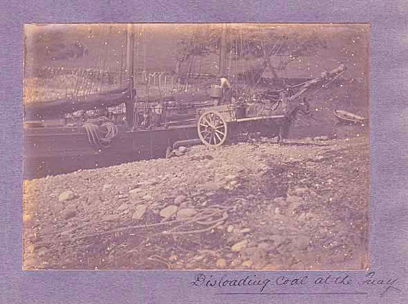
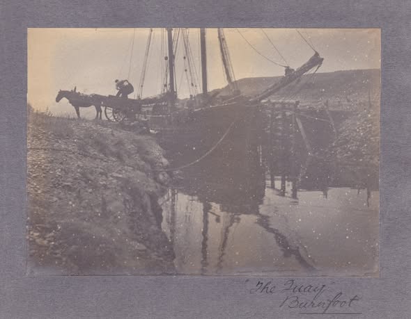
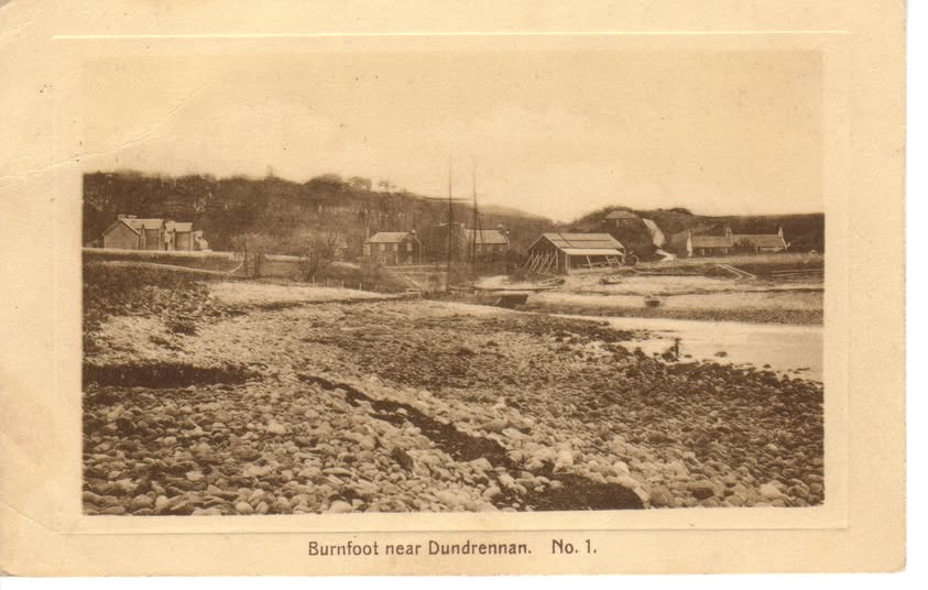
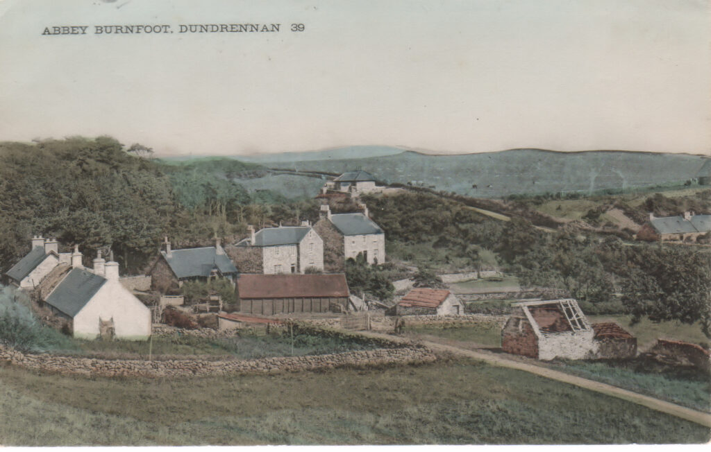
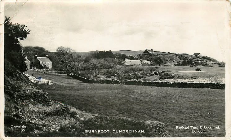
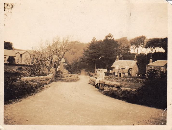
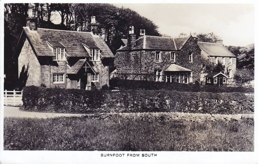
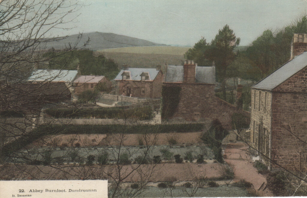
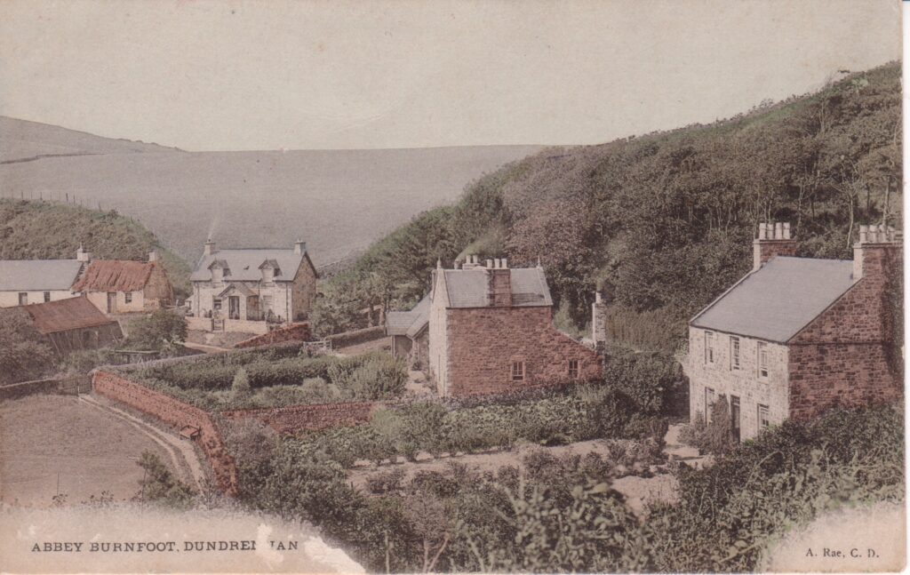
For generations the small coastal settlement of Abbey Burn Foot, near Dundrennan, was a settled and working community. It stood where the burn met the Solway, its cottages clustered within walking distance of Dundrennan Abbey. There is no coal in the Stewartry and many of our small coastal communities had harbours where coal was brought over from the Workington area and unloaded by use of horse and cart.

Life here followed the rhythm of tide and season, shaped as much by the shoreline as by the land behind it. The history of the place survives less in written record than in local memory and the traces once visible on the ground. Look at the postcards and you’ll see the charm the place once had.

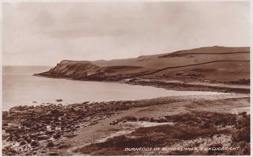
In 1942, the continuity was broken. With the expansion of wartime training needs, the coastline around Abbey Burn Foot was identified as suitable for a military firing range. The land was requisitioned, and the remaining residents were required to leave. Like many such clearances during the war, the process was abrupt and final for those involved.

The departure marked the end of the village as a lived-in place. Houses that had been homes were left standing in an emptied landscape, some later used in training exercises. Over time, exposure to weather and repeated disturbance took their toll. Roofs failed, walls weakened, and the structures gradually declined.

In the years that followed, further clearance removed much of what remained. Buildings, boundary walls, and other features were taken down, leaving little visible trace. Today, locating the exact footprint of the former settlement can be difficult without prior knowledge of the site.

Change extended beyond the buildings. With no one living there to maintain the shoreline, the character of the coast altered. Tidal debris, known locally as “rack,” the seaweed and material cast ashore, began to gather in heavier bands along the shore. The word itself, long used for such drift, lends an unintended echo to the fate of the place.

Abbey Burn Foot did not disappear entirely, but it was reduced to absence: a place once occupied, now largely unmarked. What remains is a quiet stretch of coast, where the outlines of past habitation have given way to the tide and to time.


Jim Bell’s Blog: King William’s Visit

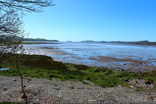
Among the traditions preserved in Kirkcudbright is the account of King William of Orange’s fleet lying for a time in the Manxman’s Lake, a sheltered bay of the Dee near the town. The year was 1689, and William was on his way to Ireland to secure Londonderry and establish his authority against the forces of his uncle and father‑in‑law, James II. The presence of the fleet caused great excitement. Crowds from the burgh and countryside flocked daily to the shore to see and salute what they called the Deliverers of Britain.

Continue reading…